goo blog サービス終了のお知らせ 

WONDERFUL IZU !

- - The place where I was born - -

Tombolo phenomenon of Minokake island

2018-07-07 | IZU PENINSULA GEOPARK


The TOMBOLO phenomenon occurs when an island (or islands)
normally separated from the mainland by the sea-shore becomes connected to the mainland by sandy or stony land appeared above the surface at low tide time.
This picture is the tombolo phenomenon occurred between the Minokake island and the mainland of Ose, Minamiizu-machi (Southern part of Izu peninsula).
The picture was taken at just 1200JST of June 28,2018 (low water time of the Spring Tide day)
This tombolo is about 200m long and 20-30m wide .
The tidal range (height difference between high water and low water) of the day was 1m50cm .
This tombolo phenomenon of Minokake island of Ose is not known well to the public yet but it is like this photo and wonderful/artistic.
When high water time, the small ship (Japanese TENMA) can cross over the tombolo just between Minokake island and mainland.

Izu Peninsula as GGN

2018-04-22 | IZU PENINSULA GEOPARK


Congratulation !!!
UNESCO has designated Izu peninsula as Grobal Geo-park on April 17,2018.
It is the 9th GGN in Japan following Mt.Apoi in Hokkaido(in 2015).
Izu Peninsula is the only area in Japan which is located on the Philippine Sea plate and it was created , about 600,000 years before,
after a volcanic islands collided with Honshu Japan, thanks to northward movement of the plate. Izu peninsula is a valuable place if we think about 4.5 billion years history of the earth.

What is Geopark ?

2015-07-05 | IZU PENINSULA GEOPARK
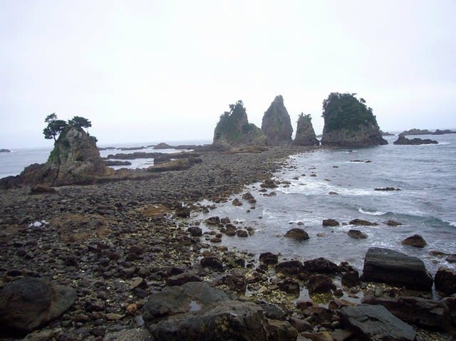
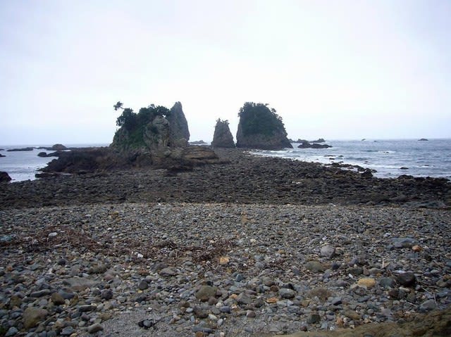
Geopark is an area with an expressed geological heritage and a strategy for a sustainable economical development, and the promotion of that very development to the benefit of the local community.
At this moment(2014), there are 36 geoparks recognized by Japan Geopark Network, among which 5 were recognized by Global Geopark Network (UNESCO).

Izu Peninsula authorized as Japanese Geopark

2012-12-03 | IZU PENINSULA GEOPARK

Izu peninsula was recognized as Japanese Geopark on September 24,2012, by Japan Geopark Commitee. There are 108 geosites in Izu peninsula, such as Jogasaki coast, Omuro mountain, Iro Shinto shrine(Minamiizu), Ose saki(Heda), Old Gold mine of Toi, and so on. All of these geosites are very valuable assets where we can observe and study the history of Izu peninsula about when and how this peninsula was formed.

How and when was Izu Peninsula fromed ?

2012-12-01 | IZU PENINSULA GEOPARK


[History of formation of Izu peninsula]
About 20 million years ago, a submarine volcano erupted in the south sea. It erupted repeatedly and it became bigger and bigger. Then the top of the mountain appeared above the surface of the sea. This is the first show-up of Izu peninsula. And the mountain grew more and more and became an island with other volcanoes erupting on it. In the meantime, the island kept movig to north, as the island was on the earth Plate (Philippine Plate).
About 600,000 yeras ago, the island finally made docking with Honshu of Japan, with many other volcanoes keeping eruption on the surface of the island(Izu peninsula). The volcanoes gradually ceased eruption by and by. Thus the present Izu peninsula was formed.